Back in the day before satnav and google maps were a thing, a printed map was the best option for finding your way around London. One of the earliest printed maps of city, the Civitas Londinum, was first produced some time in the early 1560’s and then updated around 1633. The original map was printed from carved woodblocks, a rather tricky technique, since the image is carved in reverse.
This is so the writing and orientation do not end up backwards, (the way print on a t-shirt turns out if you take a selfie). At 6ft by 3ft the printed map was not exactly pocket size but its scale allowed an amazing level of detail.
The map was thought to be produced by the surveyor Ralph Agas (c.1540-1621) and was known as the Agas Map. This is no longer thought to be true and the map’s original creator remains a mystery. There are no surviving copies of the earlier version of the map, but there are copies of the 1633 update. This version bears the Stuart coat of arms, since Queen Elizabeth died in 1603.
Fortunately for us, the Agas map has been digitised by the University of Victoria and this digital version is known as MoEML (Map of Early Modern London).
You can access it for free online at https://mapoflondon.uvic.ca/citing.htm.
I can’t recommend the digitised version enough. It is a fantastic resource for students, historians and of course, authors of historical fiction, allowing you to take a virtual tour of early modern London. You can zoom in to get a detailed picture right down to the level of an individual house. You can search by categories for particularly entities such as bars, bookshops, churches, prisons, parishes, play houses, victualling houses (or Inns and taverns), markets, halls, hospitals, and gates.
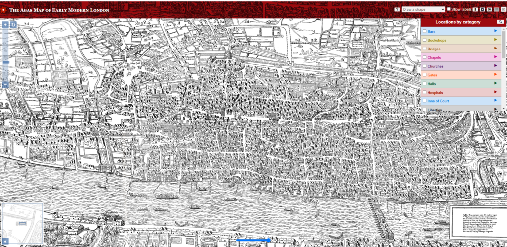
This is how it looks on screen.
Want to find the location of The Mermaid Inn – a favourite haunt of both Ben Jonson and Shakespeare? Then click on ‘victualling houses’, and follow the drop down menu until you get to Mermaid Inn. When you click on an entry the particular street, area, or feature is highlighted in a different colour to make it easy to spot. The site also provide links to information regarding each feature or site. It truly is total history-nerd heaven.
Be warned, this site can be addictive, and like me you might find the quick five minutes to look something up, easily turns into an hour or more. All in the name of research.
Jenstad, Janelle, dir. The Map of Early Modern London. Victoria, BC: University of Victoria, 2006-present. mapoflondon.uvic.ca.
THE AGAS MJenstad, Janelle. The Agas Map. The Map of Early Modern London, Edition 6.6, edited by Janelle Jenstad, U of Victoria, 30 Jun. 2021, mapoflondon.uvic.ca/edition/6.6/map.htm.AP OF LONDON
© 2022 All rights reserved
Made with ❤ in Australia